Long before European settlement, the land that is now Bluemont, Virginia, formed part of a well-used Indigenous corridor centered on Snickers Gap, a natural passage through the Blue Ridge Mountains. The surrounding slopes, hollows, and ridgelines were regularly used for seasonal hunting, travel, and communication between peoples living in the Potomac River watershed and those inhabiting the Shenandoah Valley and Piedmont. The area around modern Bluemont was further shaped by the travels of the Iroquois, or Haudenosaunee Confederacy. Although they did not maintain permanent settlements on the eastern slope of the Blue Ridge, they regularly passed through Snickers Gap during long hunting journeys and wartime movements in the seventeenth century.
The trail that runs through what is now the town center of Bluemont began as an Indigenous footpath along the eastern base of the Blue Ridge and through Snickers Gap. Algonquian-speaking peoples, including the Doeg and Piscataway, traveled this corridor from communities east of the mountains, particularly along the Potomac River, while Siouan-speaking groups such as the Manahoac and Monacan moved through the area between their Piedmont villages and hunting grounds beyond the Blue Ridge. This footpath was later formalized as Snickers Gap Road and, by the nineteenth century, improved and incorporated into the Snickersville Turnpike, one of the earliest transportation routes used by settlers crossing the Blue Ridge.
By the early 1700s, most Indigenous peoples had left the immediate Bluemont area due to the combined effects of European-introduced diseases, the spread of colonial settlement into Loudoun County, and the shifting balance of power among Native nations. The Treaty of Albany in 1722 formalized this displacement, pushing many Indigenous communities west of the Blue Ridge and opening the region to colonial expansion.
Virginia was one of the earliest American colonies, with settlements along the Atlantic seaboard from the early 1600s. Several colonial and early American roads converge near present-day Bluemont, and for good reason. William’s Gap (now known as Snickers Gap)—along with Ashby’s Gap (Route 50) to the south and Vestal’s Gap (approximately Route 9) to the north—was a major trade outlet from the fertile Shenandoah Valley to markets in the East. Colchester Road, which ran from the Gap to the Little River and thence to Alexandria, had been in use since at least the 1730s. Its name survives on a road cutting into present-day Snickersville Turnpike (Route 734) a few miles east of Bluemont. The Turnpike’s beginnings trace to 1731, when Warner Toward received a land grant for a toll road “that leads to Williams Cabbin in the Blew [sic] Ridge” connecting to the road from Ashby’s Gap to Alexandria (Jean Herron Smith, From Snickersville to Bluemont, p. 7). Despite these connections, the area where Bluemont village now lies remained largely unsettled because much of Northern Virginia, from the Rappahannock to the Potomac, was reserved for generations by the Fairfax family.
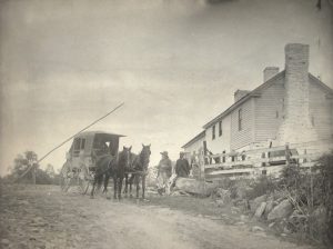
Toll Gate Image by Frances B Johnson
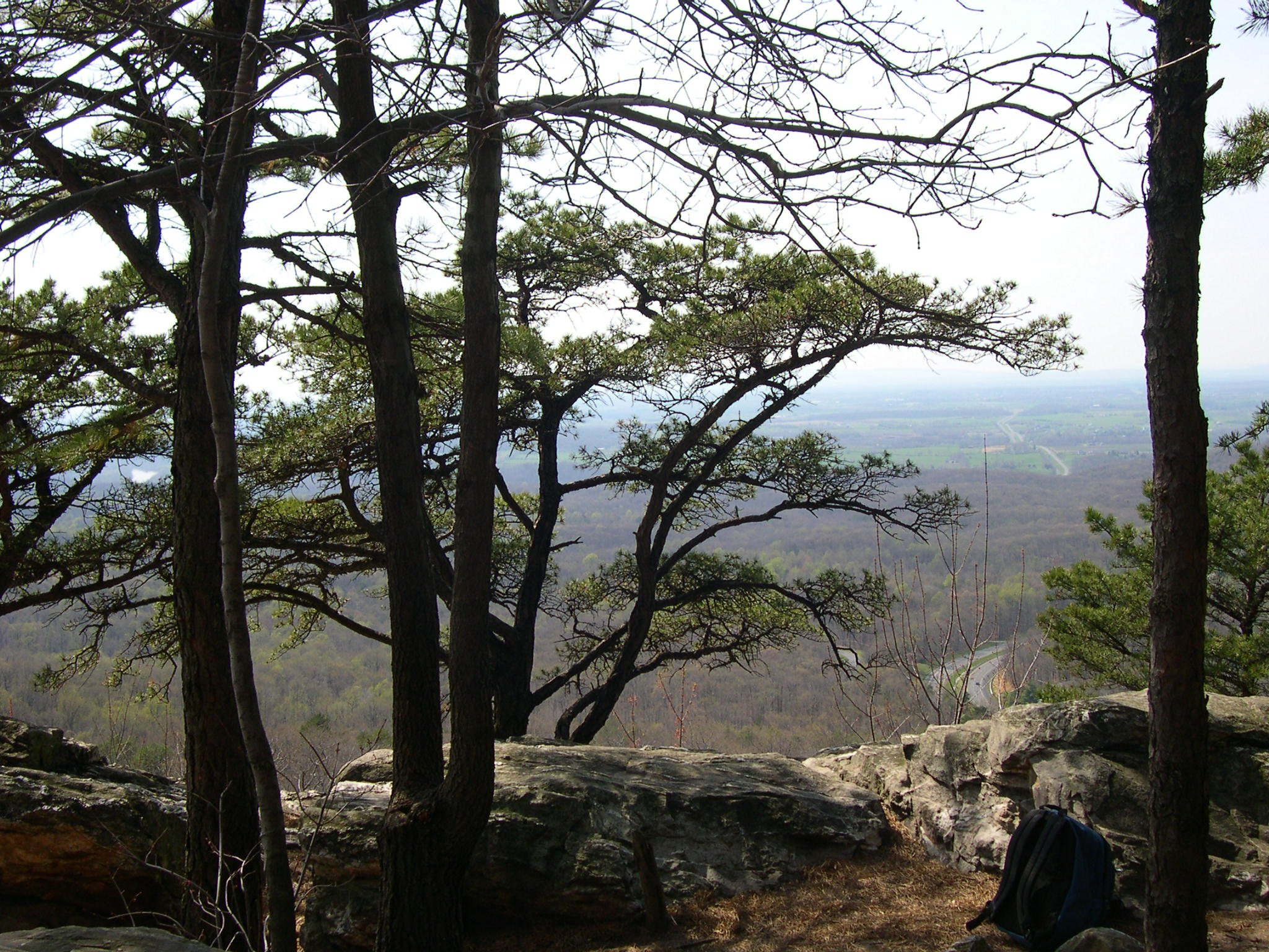
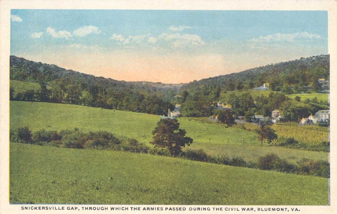
Snickers Gap, Bluemont, VA
On April 12, 1748 George Washington rode through the Gap (then known as William’s Gap) the mainstay of the Bluemont landscape, on a trip to survey land in the Shenandoah Valley. Loudoun County, with Leesburg as the county seat incorporated in 1757. A tract of 2941 acres on the eastern and western sides of the Blue Ridge was transferred from Fairfax first to George Carter, then to John Augustine Washington (George Washington’s brother).
Captain Edward Snickers (born about 1735-died 1790) then purchased 624 acres of this tract in 1769. Captain Edward Snickers, who had served in the French and Indian War was first referred to in early legal documents as a “yeoman”. Later in 1772 Snickers was called a gentleman, horse trader, tavern keeper, wagoner, military supplier, plantation manager for others and planter for himself, and land speculator—a well-to-do gentleman with extensive landholdings. George Washington used Snickers’s horses and wagons to haul supplies between Alexandria and Winchester for the Virginia Regiment during the French and Indian War and for his own purposes thereafter. Beginning in the 1750s Washington also sometimes stopped at Snickers’s tavern (ordinary) located near where Snickers’s ferry crossed the Shenandoah River. In his diary, Washington mentions “stopping at Snickers, sometimes for the night and sometimes to bait.” Besides operating a tavern, a ferry, and hauling goods and produce for sale, at various times Snickers was a builder and overseer of roads and was the owner of a merchant mill, a blacksmith shop, a grist mill, and a sawmill. Despite these various endeavors, he made his fortune primarily by buying and selling land. He married Elizabeth Taliaferro about 1755 and they had four children.
Set out from Charles West’s [an inn near present-day Aldie] dined at Snickers and got to Mr. Wr [Warner] Washington about 5 o’clock. [August 8, 1769] … Continued my journey and reached Charles West’s ordinary [a price-regulated inn] after baiting [fishing] under the ridge at the blacksmith’s shop [that is, at Snickers Gap]. [August 11, 1769]
Washington may have first known Snickers as a wagoner hauling supplies out of Winchester during the French and Indian War (1754-1763). In 1777 Snickers received a personal letter from General Washington asking him to sign on as Wagonmaster General for the patriot army. Snickers declined, probably due to ill health. Snickers became a commissary for the Virginia forces on the frontier early in the Revolution, but this came to an end in December 1777 when he was accused of fraud on a job provisioning the army, but no legal action took place [see chapter 7, Edward Snickers Yeoman and scattered references to Edward Snickers’s multifarious business activities in the Frederick County records.] As the war wore on, an Edward Snickers was listed on the roster of wagoners with the 11th Brigade Artillery of Jean de Rochambeau, commander of the French Expeditionary Force in America. After the war, Washington asked Snickers to serve as his land agent in Frederick County.
Divisions in the War of Independence among the peoples of northwest Virginia reflected different streams of immigration—German, Quaker, Irish, and Scots-Irish, generally from north of the Potomac or the Shenandoah Valley—as well as settlers from the older settlements closer to the Atlantic coast. Indentured servants were more the norm than slaves—with slavery in Loudoun County most prevalent in the south and eastern areas. Yet Edward Snickers was an enslaver of at least 62 people, as noted in his will.
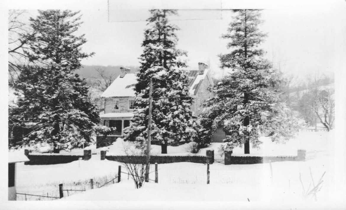
In 1777 Edward Snickers sold his 624 acres on the east side of the Blue Ridge to Richard Wistar of Philadelphia. In 1792 upon Wistar’s death, Richard’s son Dr. Caspar Wistar sold it to William Clayton, who established a farm on the eastern shoulder of the Blue Ridge just south of the Gap—the site of present-day Bluemont. It was his son Amos Clayton who built the handsome stone manor house, Clayton Hall, which today still graces the corner of Snickersville Turnpike and Clayton Hall Road.
Clayton Hall, Bluemont VA
The Claytons (and the Osburns, another early family) were loyalists in the Revolutionary War. William Clayton may have been the “Tory Spy” who brought about the September 20, 1777, “Paoli Massacre” of 300 men under Brigadier General Anthony Wayne in Pennsylvania. Clayton then became a member of John Butler’s Tory Rangers. [Harrison Williams, Legends of Loudoun.]
The Claytons sold off several lots to different families, while the Osburns may have already settled here. Early families of Bluemont include John Chew (married Margaret Reeder), John Osburn (married Sarah Morris), Nicholas Osburn (married Mary Lumm), Mordecai Throckmorton (married [1] Mildred Washington Throckmorton [2] Sara McCarty Hooe), William Lodge (married Christiana Purcell), Thomas M. Humphrey, Jr. (married Mary Marks), William Bradfield (married Elizabeth Latimer Alder), James Murphy (married Nancy J. Alder), and the Reverend John Marks (married Uriah Ledyard). (See genealogies in From Snickerville to Bluemont.)
In the spring of 1778, Edward Snickers took it on himself to aid the war effort by rounding up several young men from the Quaker settlement now called Lincoln (about 10 miles east of the Gap), bringing them north under armed guard to the Revolutionary Army camp. “I know some of these men,” Washington reportedly told Snickers on meeting the young Quakers. “They neither swear nor fight.” Then he admonished the reluctant recruits to go home and cultivate as much food as possible for the support of the patriot troops. [J.V. Nichols, Legends of the Loudoun Valley.]
By 1785 the Virginia legislature appointed commissioners to manage the turnpikes in the Western part of the state. The 1809-10 Virginia General Assembly provided state funds for the 13.7-mile turnpike (now Snickersville Turnpike) from Snickers’ Ferry. Toll gates were probably set up at Aldie, Mountville, and the Gap. The Leesburg and Snickers Gap Turnpike (present Route 7) was completed in 1831.
In 1813, William Clayton willed four lots to his children. In 1825 William’s son Amos Clayton donated one-half acre of land for a school, nondenominational church, and village meeting hall—the Snickersville Academy—a log structure that now stands unattended across the turnpike from Clayton Hall. The first postmaster came on board in 1807.
The village’s incorporation papers in 1824 describe it as:
“…ten acres at the entrance of Snickers Gap, of the Blue Ridge Mountains in the county of Loudoun, property of Amos Clayton, Martha Clayton, William Woodford, and others, as soon as the same shall be laid off into lots with convenient streets and alleys.’ The first trustees were James Cochran senior, Craven Osburn, Mordecai Throckmorton, Stephen Janney, Doctor E.B. Brady Amos Clayton, and Timothy Carrington.”
-Harrison Williams, Legends of Loudoun, p. 168
“The village, variously called Snickers Gap (incorporated 1824), Snickersville (incorporated 1830, when Perrin Washington, nephew of George Washington was postmaster), and Bluemont (1900) was taking shape.
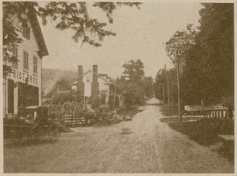
The Price Bros store, around 1901, now operates as the Bluemont General Store
In the early years of the 19th century the village had grown to an active little business place, with tavern, stores, blacksmith, wheelwright and other shops of artisans, such as at that day were needed to supply the wants of a neighborhood.”
In the 1840s, a General Store opened to serve the local population and travelers, and the Bluemont General Store is still operating in that building today.